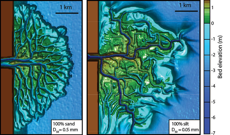
Top-down view of deltas created in Delft3D. The shape of deltaic land changes if it is created from a sediment supply of (a) sand or (b) silt. Modified from Edmonds, 2012 & Caldwell and Edmonds, 2014.

Top-down view of deltas created in Delft3D. The shape of deltaic land changes if it is created from a sediment supply of (a) sand or (b) silt. Modified from Edmonds, 2012 & Caldwell and Edmonds, 2014.
Deltas are one of the most important depositional environments; ~10% of humans live around deltas and ~35% of oil and natural gas is recovered from ancient deltaic deposits. However, these environments will change as sea-level rises and alters the interplay between water flow and sediment. The easiest way to maintain deltas against sea-level rise is layering on additional sediment, which can fill the space otherwise occupied by rising seas. Unfortunately sediment is a limited resource in most deltaic systems because dam construction on rivers upstream has stopped sediment movement to the delta. Our research on deltaic systems is focused on developing science needed for restoring these environments and needed for stratigraphic models to aid oil exploration. To do this successfully, we focus on understanding the natural processes on deltas that move and deposit sediment, and how to use these processes to create sustainable management solutions for endangered deltas. For example, the use of models has allowed us to explore how the shape of deltaic land changes under various boundary conditions.

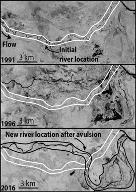
An example of a river avulsion in S. America. Notice how the initial river location moves from its location in 1991 to a new location in 2016. This is the process of avulsion.
Rivers are dynamic features that move, twist, and wiggle as they carry water and sediment from mountains to the coast. Possibly the most dramatic river movement is the avulsion, which is the wholesale abandonment of the present river in favor of a new location on the adjacent floodplain (Figure 4). Understanding this process is critical because of the widespread flooding produced by avulsions. For example, the Yellow River in China has avulsed twelve times in the last 200 years resulting in thousands of deaths. But avulsion flooding also deposits huge volumes of sediment that create good reservoirs for oil and natural gas, fertile floodplains, and over geologic time substantial parts of the stratigraphic record. Improved understanding of avulsion processes will help to manage rivers and mitigate hazards, and also enhance our ability to interpret and predict fluvial stratigraphy for earth history, climate reconstructions, and subsurface resources.